Day 1, Aritao to DENR
Office, Bokod, Benguet, March 24
Our stay at the PNP station was very comfortable and the PNP
Chief was himself a biker. We started pedaling from Aritao (elevation 385
meters above sea level) at 6AM after a quick cup of instant coffee (it is our
habit to bike for about 1 to 2 hours in the morning before having a heavy
breakfast). The Benguet-N. Vizcaya Road (concreted and connects to Baguio City)
started out deceivingly flat for a few kilometers and started climbing until
reaching 660 meters and it was a downhill ride to a river in Pingkian 15 km
from Aritao. From there, it was again steady climb to Kayapa (where we had
breakfast) and further up to 1,560
meters in elevation into the province of Benguet.
 |
| Security was not an issue during our stay in Aritao |
 |
| First ascent of the trip |
 |
| The road to Kayapa, N. Vizcaya |
 |
| Getting by with a little help from a friend |
 |
| A well preserved pine forest between Kayapa and Bokod |
After a long downhill, we had our very late lunch at the Bokod junction, elevation
844 meters. To the north is Kabayan and Bokod, Benguet and to the west is Ambuklao
Dam and Baguio City. It was already 5PM when we started out to the DENR office
8 km away. At the town of Bokod, we bought fuel for the stove and supplies for dinner and breakfast. After Bokod the road
increasingly got steeper until it got impossible to ride the bike in the
incline even with the chain on the 10th sprocket. So we dismounted
and walked (in the dark). After an hour more of walking-biking, we reached the
DENR office at 7PM where we were met by Mr. Roy who has been waiting for us.
I have coordinated earlier with the office of the DENR Protected
Area Superintendent (PASu) since Mt. Pulag is a popular mountaineering
destination and usually gets crowded during weekends, holidays and in the
summer months. Mr. Roy is familiar with our itinerary and has even arranged for
our accommodation. He recommended a house within the Benguet State University
Bokod satellite campus which is used by transients. This is a recommended
lodging arrangement for only P 125 per person for a two-bedroom house with
kitchen and bathroom. The elevation of DENR office is 1,375 meters. Reference to
elevation will be a recurring part of this blog since an MTB ride in the
Cordilleras is more about elevation gain/loss than distance.
 |
| Bokod-Ambuklao junction, 8 km to the DENR office, about 50 km to Baguio City |
 |
| Ed doing the laundry, a must for everyone on the trip |
We cooked and ate dinner, did our laundry, had a few shots
of brandy and had a very good night sleep. Distance covered for the day: 66 km. Estimated elevation gain: 2,235 meters.
Day 2, DENR Office to
Mt. Pulag Camping Ground, March 25
A visit to Mt. Pulag starts with an orientation at the PASu
Office of the DENR (which is just adjacent to the BSU Bokod campus). After Mr.
Roy’s orientation, we paid the fees and bought supplies from the local stores
near DENR office. We also arranged for a motorcycle to haul the camping
equipment and supplies up to the Ranger Station (which would prove to be a good
decision). We started the ascent to the Ranger Station, 10.7 km away and 1,050
meters up, at 9AM.
The Bokod-Ambangeg Trail/Road is 90% “unbikable” going up. We
were walking and pushing the bike most of the time. The road is mostly unpaved
but concreted in critical parts. There are road sections with slope of 40% and
the ascent was relentless. But the unfolding panorama of the Cordilleras was,
of course, breathtaking.
 |
| The nth rest stop |
 |
| Unbikable sections |
 |
| Bikable sections |
After many rest stops, snacks stops, picture stops,
piss stops, a lunch stop, text stops and other stops, we arrived at the Babadak
Ranger Station at 2:30PM. We arranged for a guide, a porter, packed for the
trekking leg, and parked our bikes inside the Ranger Station for safekeeping. I
also retrieved our rented tents which I had reserved earlier thru the DENR
office. To save on weight, I have opted to rent instead of bringing tents (which
was a bad decision).
Off we trekked from Babadak at around 3:30PM, passed the
highest vegetable farms in the country, past the mossy forest of Mt. Pulag and
reached the camping ground at the grasslands at 5:45PM. We pitched camp, cooked
dinner, ate and retired for the night.
 |
| Most of the porters in Mt. Pulag are women |
 |
| Into the mossy forest |
 |
| Abner (in white shirt), our guide |
 |
| Adobo and rice at 2,695 meters above sea level |
Kareen and I had very little sleep because of the cold. The rented
tent is in bad condition and a zipper is busted which allowed the circulation
of cold and wet air inside the tent. Lesson learned: bring your own lightweight
and compact tent. Hypothermia is a real danger in Mt. Pulag where temperature
can plummet to single digits C at night even during summer months. One must have
experience in basic mountaineering before climbing Mt. Pulag.
Day 3, Mt. Pulag, then
to Kabayan, Benguet, March 26
This is the longest, most exhilarating and most exhausting
day of the whole trip.
We started at 4AM, trekking in the dark in a surreal
grassland landscape lighted only by our headlamps, and arrived at the summit at
5:45AM just in time for the famed Mt. Pulag sunrise above the clouds. Mt. Pulag
is the third highest mountain in the Philippines at 2,922 meters
ASL.
 |
| Picture perfect Mt. Pulag sunrise |
 |
| Above the clouds |
 |
| We chanced upon Boboy (at right), co-founder of UP Mountaineers, and Ed posed with his co-seniors |
After an hour at the summit, we started the descent to the
camp. Breakfast, break camp and then started the 2-hour trek to Babadak at 9AM.
 |
| Kareen cooking breakfast |
 |
| Noel (UPM'91), Kareen, Tyrone and Ed in the trekking mode |
 |
| Transition into biking mode |
At Babadak, we had our lunch, re-packed and prepared for an EXTREME
downhill ride.
Since we were headed to Kabayan, we decided to try the Bashoy-Babadak
trail/road. In my opinion, this is one of the most extreme downhill ride in the
Philippines. The road is mostly gravel surface (very difficult) and the few concreted
portion is a two 0.25 meter wide strip for 4-wheel vehicle. The cliffs at the
roadsides are frightening. It was a hot day and there are no trees along the road
(only vegetable gardens all the way down). It was a scenic route but we have to
concentrate on the road. The elevation dropped 1,370 meters in 9 km. This
downhill ride was most difficult for Kareen for she was using mechanical
V-brakes while we had pneumatic disc brakes.
The downhill road met up with the Bokod-Kabayan-Buguias Road
near the Agno River. From there, the road (mostly earth surface) undulates as
it followed the course of the Agno River due north. We reached Kabayan at
around 6PM very exhausted and drained. Laspag! Dinner at a carinderia and
headed straight to bed. Distance travelled by bike is 19.5 km for the day.
 |
| Pinecone Lodge, Kabayan, Benguet, very clean, affordable, highly recommended |
Day 4, Kabayan to Mt.
Data, Bauko, Mt. Province, March 27
I am from the lowlands and my impression of Kabayan is that
of an idyllic small Cordillera town. To the east is the towering ridge of Akiki Trail
to Mt. Pulag and to the west is the gorge of Agno River with rice terraces on
the slopes. Pine trees, crisp mountain air, constantly changing landscape, soft
murmur of rivers, minimal traffic – an MTBiker’s paradise.
We started out from Kabayan (1,185 meters elevation) at 7AM,
going slowly up north to the headwaters of Agno River. The road is a mix of
gravel and cement and under construction. Kabayan to Buguias town proper is
just 20 km away but it took us more than 5 hours. We had a lunch of chicken at a
small carinderia in Buguias. The town proper is very small compared to Barangay
Loo up north and Barangay Abatan at the Halsema Highway.
 |
| My bike, Giant XTC frame, Suntour Epicon X2 fork and Deore group set, with a 25 liter backpack. |
 |
| Mostly gravel road to Buguias, going up |
 |
| and up |
 |
| Having trouble with my rear brakes |
At Barangay Loo is a wide plateau that is cultivated to
vegetables and other crops. After this barangay, the road goes into a steep
climb to Abatan and joins the Halsema Highway. Abatan is an urbanized barangay
due to its proximity to the Halsema Highway. It is also the main vegetable
trading post in the area. Along the Halsema Highway are business establishments and
vegetable farms. From Abatan, the road is downhill for a few kilometers and
then goes on a long uphill again going to Mt. Data, Bauko, Mt. Province
 |
| Very extensive vegetable gardens at Barangay Loo, Buguias |
 |
| Into Bauko, Mt, Province, still going up |
It was our plan to reach Bontoc this day, but exhausted from
the demanding terrain and nearing dusk, we opted to stay at Mt. Data Hotel (2,230
meters ASL). We usually stick to a backpacker or shoestring tourist budget during
extended bike trips. The room rates of Mount Data are not for backpackers, but
the accommodation and food is worth the money. You have to pay extra for heated
rooms. Distance covered for the day is 45 km.
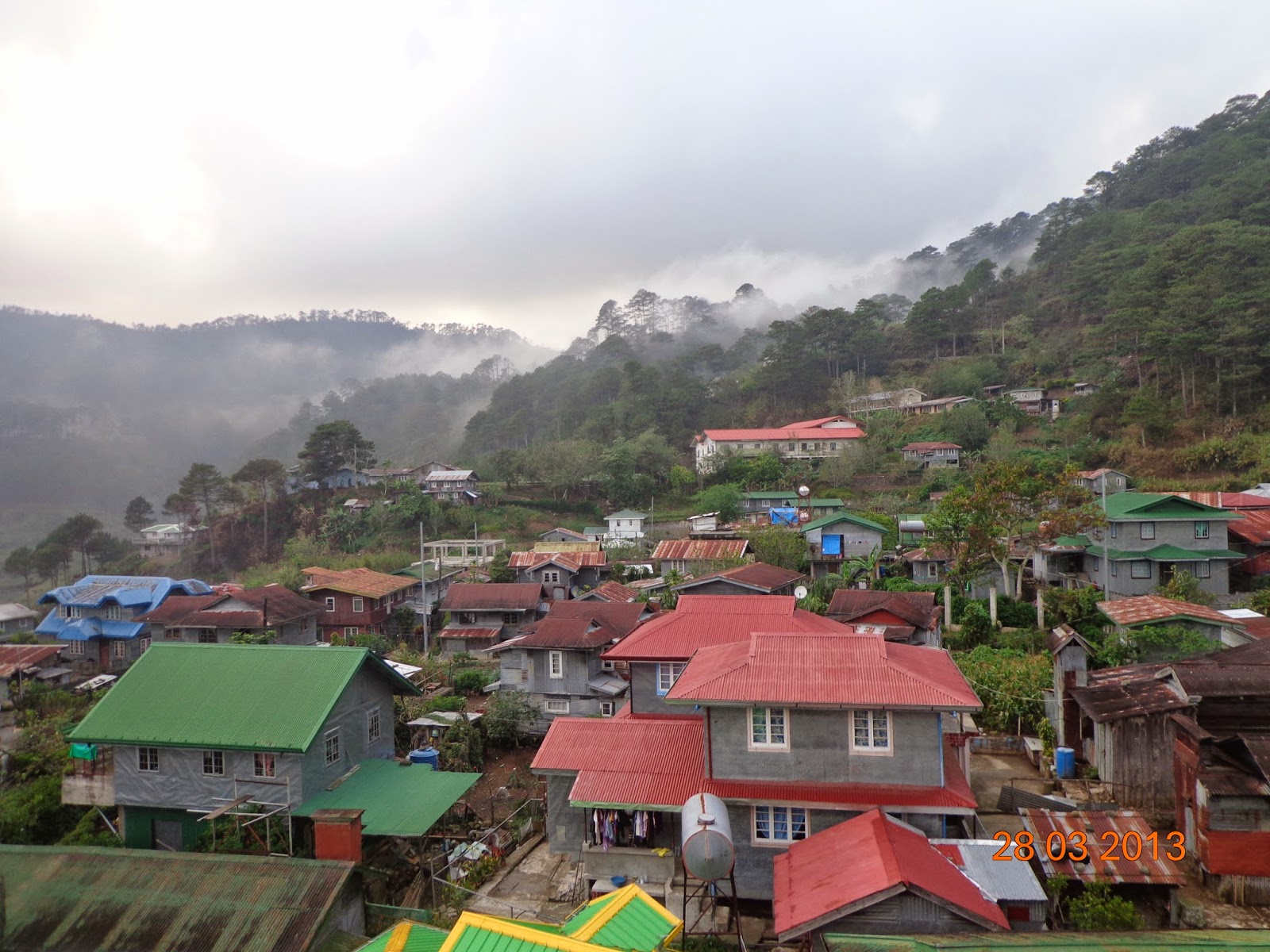
Day 5, Mt. Data, Bauko to Sagada, Mt. Province, March 28, Holy Thursday
Departed Mt. Data at 6:30AM. The section of Halsema Highway from Mt. Data to Sagada junction is downhill on a well-maintained concreted road - the most pleasant biking portion of the trip. The scenery on the cool morning easy downhill ride was amazing! After a few kilometers, we had a glimpse of the Chico River gorges on the right hand side of the road.
 |
| The Hulk at a roadside gas station-diner along Halsema Highway |
 |
| Bikes fully loaded, bikers off for breakfast |
We had breakfast at a small canteen at Sabangan near the junction of Halsema Highway and the Tagudin-Cervantes Road. There we also met the co-owner of Sagada Resthouse by chance and so we had a reservation for a lodging house in Sagada. After 40 km of downhill ride, we reached the junction of the Staunton Road to Sagada. Ahead is a 12 km ride with an elevation gain of about 600 meters.
Slowly, patiently we climbed the scenic Staunton Road and by 2:30 PM reached Sagada.
Day 6, Sagada, March 29, Holy Friday
Sagada, even during the peak of the peak tourist season, is very enchanting. We arranged for a guide (named Don, with an eternal tear in his eyes – tattooed) and headed for the church for a prayer. The day was spent in Sumaging Cave (very crowded), a visit to the hanging coffins, echo valley and of course souvenir shops.
Day 7, Sagada to Bontoc, March 30, Saturday and to Baguio City, Manila and to Sorsogon
The plan was to ride a bus from Sagada to Baguio City but vehicular and pedestrian traffic and the sheer number of passengers waiting for the same bus made us change our mind. So instead we mounted our bikes again and biked downhill to Bontoc for a bus ride. Thus ended the bike leg of our trip with a total distance of only 203 km. I lost count of the elevation gain/loss.
The bus left Bontoc 10:30AM and we arrived at Baguio City at 3PM where we stayed overnight. Sunday early next morning, we lined up at the Victory Liner bus terminal as chance passengers, rode a bus to Manila by mid-morning, arrived at Cubao by late afternoon, proceeded to the Ali Mall bus terminal, and rode a bus to Bicol for another 12 hours of ass-busting ride.
Here is the route map (reconstructed using Google Earth):
By Noel Mercado II


i miss you guys.... take care always. mwua mwua tsup tsup
ReplyDelete