This is a blog of an epic bicycle ride undertaken by a group
of Sorsogon cycling enthusiasts during the Holy Week of 2012. I describe this
ride as epic in consideration that it traversed the provinces of Ilocos Sur and
Norte, Cagayan, Kalinga, Mt. Province, Ifugao, N. Viscaya, N. Ecija, Bulacan to
Metro Mania in an eight day unsupported ride of 999 kilometers. The major ascents/descents
of the ride includes Lubuagan (Kalinga), Sagada, Mt. Polis (near Banaue at
1,910 meters ASL) and the Dalton Pass.
The ride is named “Lakbay Bisekleta 2012” by the Irosin
Cyclists Association and the fourth cross-country of the team composed of Noel
(me), Ed of Matnog, Tyrone and Jenor of Bulan, and Jeffrey of Sorsogon City
(now of US of A). We travelled by bus from Sorsogon to Manila (12 hours) and
from Manila to Vigan City (10 hours). At Vigan, we were graciously accommodated
by my town mate Marsha of Marsha’s Delicacies and she (again) was our host.
 |
Day 1, April 1, Vigan City to Pagudpud, Ilocos Norte
Started out early with Derrick (Marsha’s husband also a biker)
to Vigan Cathedral for a short prayer and we met up with Vigan cyclists who will
accompany us up to the Ilocos Norte boundary. At 6:30 AM, we were off north the
Manila North Road with light traffic in flat terrain and with the mountains of Cordillera
on our right. The dominant crops along the road are tobacco, garlic, onion and
other high value crops. At Sinait, Derrick and the Vigan bikers turned back for
Vigan and we were on our own.
 |
| Ed, Tyrone, Derrick and Marsha, Jenor at Marsha's Delicacies |
 |
| The Vigan bikers |
Anyway, we arrived at Laoag City by 11:30 and had lunch in carinderias near the church. After a few kilometers past Laoag City, the road met up with the sea and we were rewarded by scenic seascapes and challenged by fierce headwinds.
 |
| At Marcos Museum in Batac |
 |
| The cross-country bike addicts of Sorsogon, Noel (me), Jenor, Ed, Tyrone and Jeff |
The headwind (of about 20 kph) was consistent up to Burgos and our progress was very slow. No wonder this area was chosen as the site for the wind farm! After Burgos, we detoured for the Bangui wind farm near the sea. The air was humming with electricity coursing through the transmission line and the wind was really blowing and turning the gigantic blades.


The sun was already setting as we reached Pagudpud, the northern-most town of Luzon Island. We looked around for a place to stay near the beach in the dark and ended up in Tartarugas Hotel where the staff was very accommodating and arranged for a 10-hour stay in a house. Bike distance is 164 km with an average speed of 19.3 kph.

Day 2, April 2, Pagudpud to Aparri, Cagayan
We loitered at the Saud Beach of Pagudpud for a while, had
breakfast and took off late at 7:30AM.

The terrain from Pagudpud to Sta. Prexedes, Cagayan is
rolling and this is where the northern edge of the Cordillera mountain range
plunges into the sea. We traversed the Patapat Viaduct, a concrete coastal
bridge 1.3 km long connecting the highway of Ilocos to Cagayan. The bridge is a
sight to behold as it straddles the mountain slope and beneath is a rocky
beach. A whale (a blue whale perhaps) was sighted surfacing and blowing.
 |
| Where the Cordilleras and the sea meet. |
After Sanchez Mira, we turned
southeast inland into the valley of Cagayan. By 11:30 we reached Claveria where we had lunch. The town of
Aparri is due east across Cagayan River and the nearest bridge is near Lal-lo
and that means a long detour to the south. Luckily, somebody told us that there
is a short cut in Barangay Bangag of Aparri where small boats can ferry people
(and our bikes) across the mighty Cagayan River direct to Aparri. In a junction
in Bangag, we left the main road, turned east and arrived in a small sitio at
dusk where a boatman offered to ferry us for P50 each.


The boat ride was in itself an adventure amid the current
and sandbars of Cagayan River in the dark with only flashlights as
illumination. But the boatman was familiar with the terrain and was navigating
using the urban lights of Aparri. We arrived at Aparri at 7PM, had dinner and
checked-in at Versoza Hotel.
 |
| Crossing Cagayan River by boat. |
Distance travelled for the day is 142 km at 17.9 kph average
speed.
Day 3, Aparri to Tuguegarao City
Day 3 started with a visit to the Aparri port where we
watched the eddies as the Cagayan River met up
with the sea. We will be following this river south up to Tuguegarao City and
up to the headwaters of its tributary the Chico River. We left Aparri at 6:30AM
for the heart of Cagayan Valley.


It was summer and it was hot, especially in this area. To
our left is the outline of Sierra Madre mountain ranges and the Cordilleras at
the right. In the middle is vast rice lands and it was the summer harvest
season. The road was filled with palay drying in the sun. We had lunch at
Alcala by 11:45 and reached Tuguegarao City by 2:15PM where a relative of
Tyrone offered her house as our pit stop for the day. Did laundry (which dried
by early evening), sampled batil patung and biked around the city.
We travelled 102 km in a very flat terrain with an average
speed of 19.8 kph – slow, in the oppressing heat of Cagayan Valley in the
middle of summer.
Day 4, Tuguegarao
City to Tinglayan, Kalinga
Early morning, we proceeded to the Tuguegarao Cathedral to
meet up with Bishop Utleg. I have known Bishop Utleg from his trip to Bulusan Volcano where I served as guide on 2010. The bishop was about 70 years old when he hiked
Bulusan Volcano and trekked unassisted up to the crater and back.
 |
| Breakfast with Bishop Utleg |
Bishop Utleg graciously offered a light breakfast for the
group and blessings for a safe ride. By 6:15AM, we were off from Tuguegarao
City and crossed the Cagayan River again via Buntun Bridge going to Enrile,
Cagayan. After Enrile, the road started to undulate until we reached Tabuk,
Kalinga by 10AM where we had early lunch. A curious motorist named Erwin (also
a biker) asked for our destination and was surprised that we are starting off
late for Tinglayan. He seemed worried of the possibility of us travelling in
the dark in this particular road section.
 |
| Cagayan River under the bridge. |

A few kilometers from Tabuk, we crossed Chico River and met
up with the Mt. Province-Kalinga Road which is an extension of the Halsema
Highway. We turned left and the road snaked its way upstream along the Chico
River steadily gaining altitude.


The uphill ride to Lubuagan was long and relentless but the
road was surprisingly concreted, well-maintained and with impressive slope
protection. I have heard stories about Lubuagan being a really remote Kalinga
town where tribal wars can get deadly, and some stories of the road being
dangerous to travelers. Well, the town is remote, atop a mountain, in the
middle of Kalinga, but peaceful on first impression. We stopped by near the
municipal hall at 3 PM and had snacks.

Traveled 120 km for the day with an average speed of 14.7 kph.

This road section is very challenging despite being
relatively flat and slightly undulating. There are portions where recent
landslides have eroded the road. Any miscalculation on this road by any biker
or motorist would mean a plunge to the rocky banks of Chico River several
meters to the east of the road.


 |
| The road to Lubuagan, Kalinga |

After Lubuagan is an insane downhill ride to the scenic town of Tinglayan along the Chico River. We reached Tinglayan at 5PM where we were met up by an LGU official (Erwin’s father) who escorted us to the police station. The police chief insisted that we leave the bikes at the station for safekeeping and referred us to the Sleeping Beauty Inn. The inn was a lodging house, a store and a restaurant in one. Accommodation was spartan but decent enough considering the remoteness of the place.

 |
| Tinglayan rice terrace |
Day 5, Tinglayan to
Sagada, Mt. Province
We were on the road by 6:30Am from Tinglayan going south still following the Chico River to Bontoc. In the early lights of morning,
Tinglayan in my impression has the aura of mystery and magic. It is set in the
gorges of the river and sandwiched by two mountain ridge, with cold crisp pine
scented air and the eternal soft murmur of Chico River.
 |
| Profile of the Sleeping Beauty |
Lunch was taken at Bontoc at 11AM, after which is an easy
ride in Halsema Highway up to the junction to Sagada. The ascent up the Staunton
Road took more than 3 hours and we were at Sagada by 3:30PM. The St. Joseph Resthouse
was our place for the night where a hot shower was a welcome relief for our
tired bodies.
Distance covered was 63.44 km in a slow easy average speed of
11 kph.
 |
| Staunton Road |
 |
| Sagada rice terrace |
Day 6, Sagada to Banaue, Ifugao
Strolled around Sagada in the early morning, witnessed a traditional dance in the main street and had breakfast. By 9AM we were on our way down to Bontoc for Banaue. Turning southeast from Bontoc (880 meters ASL) is the road to Banaue via Mt. Polis (at 1,900 meters ASL). The road crisscrossed rice terraces, pine forest as it steadily gained altitude past Talubin and the Bay-yo. We had a rest stop at Bay-yo in a (unusually designed) waiting shed overlooking the Bay-yo rice terrace. After Bay-yo was a long grueling uphill to Mt. Polis where we arrived by 2:30PM, had a late lunch and after which is a long downhill to Banaue. The road is in a very nice condition with frightening switchbacks, turns, cliffs and breathtaking panorama.
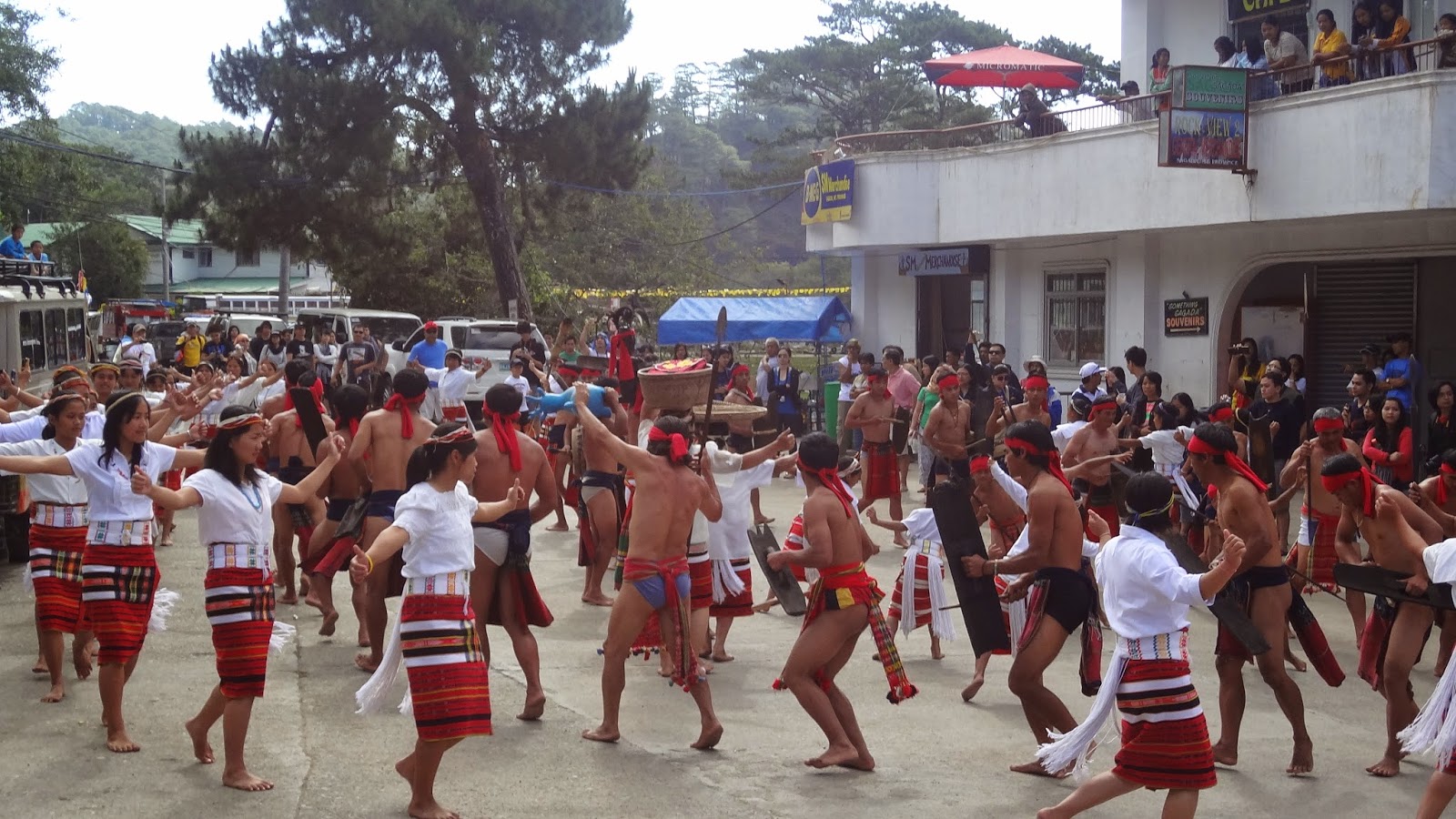 |
| Sagada traditional dance |
 |
| Bay-yo rice terrace |
 |
| The view near Mt. Polis |
 |
| Jamming at Mt. Polis |
 |
| Banaue View Point rice terrace |
Day 7, Banaue to San Jose, N. Ecija
This is the longest day in terms of bike time and distance for the whole trip. Started out 6AM from Banaue View Point to the town center where we had breakfast. The ride out of Banaue starts out with a long uphill ride then a very, very long downhill ride to Lamut. Solano, N. Vizcaya is reached by 11:30PM where Jenor and I decided to have some of our gears (and souvenirs) shipped via LBC to save weight.
 |
| Leaving the Cordilleras |
 |
| Near Dalton Pass, into Central Luzon |
We reached San Jose at 7:45PM, grudgingly looked for a place to eat and to sleep. Laspag! We stayed at Corinthian Hotel (not recommended). Distance covered is 189 km at average speed of 19.3 kph.
Day 8, San Jose to Sta. Mesa, Manila
The last day of the ride and we are all physically and mentally near drained by now. Left San Jose by 7AM into the flat, urbanized, heavily trafficked Maharlika Highway of N. Ecija and Bulacan. Back to hot and chaotic roads, passing the Science City of Munoz, Cabanatuan City (via the unused diversion road) and to Gapan by 11AM for a lunch break. Ed’s bike rack which is attached to the seat post broke down and Jeffrey’s rear derailleur drop-out snapped somewhere in Bulacan. After repairs, we entered Manila via MacArthur Highway and ended up in Sta. Mesa by 7PM.

Total distance for the day is 158 km at a fast 21 kph average speed. The next day we rode a bus to Bicol, rested for another day, and went back to our day jobs.
Great ride! Here is the route map reconstructed using Google Earth:
By Noel Mercado II
No comments:
Post a Comment